
Whether they be tsunamis, hurricanes, tornados, or fires, natural disasters and drastic weather scenarios can wreak havoc on towns and cities.
This is why knowing how to recognize storm patterns and understanding when danger is coming is essential--especially if you live in an area that is susceptible to destructive weather events.
Regularly tuning into National Weather Service reports is always recommended. Or enable alert notifications on your cell phone. However, these reports don’t always provide the most accurate information for your specific area or give you enough time to protect ourselves your family the event of a real emergency.
The solution? Equip yourself with the knowledge to spot dangerous weather events BEFORE they hit.
I’m going to share a few proven weather spotting tips for preemptively detecting storms and other natural disasters so you can protect yourself and your family.
Keep reading to discover what you should know about various weather and climate situations that could threaten your area.
Dangerous Cloud Formations
We often go about our daily lives not paying the attention we should to the clouds in the sky.
Cloud formations provide plenty of valuable information in terms of what’s going on weather-wise in our atmosphere. For example, while white fluffy cumulus clouds are common and not much to worry about, expanding and tall cumulonimbus clouds often signify weather events.
Here are a few ominous cloud formations you should be aware of…
Cumulonimbus Clouds

Cumulonimbus clouds are dense, vertical cloud formations that often resemble towers. They form when water vapor is carried into the air due to powerful upward air currents. When they are bubbling while expanding upward and outward, that’s the moment to take notice and consider action. Some people refer to these formations as thunderheads, as these clouds are typically present during thunderstorms, and often yield a significant amount of heavy rain and sometimes hail.
For the most part, you don’t need to worry about a pop-up thunderstorm unless you are outdoors. These types of clouds can result in substantial amounts of rain, causing flash floods or mudslide events.
Shelf Clouds

Shelf clouds are low, horizontal, wedge-shaped clouds that look like floating shelves in the sky. They generally form a line as the wedge moves across the sky. Severe thunderstorm wind gusts--often associated with a cold front--are usually present with this type of cloud formation. Because shelf clouds typically bring about severe winds, it’s advised that you take shelter inside should you spot this type of cloud in the sky.
Wall Clouds

A wall cloud is formed beneath the base of a cumulonimbus cloud. According to Sciencestruck.com…
“Humid air close to the ground is dragged upwards into the main thunderstorm cloud. As it travels upwards, it causes the moisture to condense, thus resulting in the formation of a wall cloud.”
Should you worry about this cloud formation? If the cloud is rotating, the answer is yes.
When wall clouds rotate, it’s an indication of a mesocyclone within a thunderstorm. This type of movement many times produces strong tornados. If you notice a rotating wall cloud, seek shelter underground or a low-lying area if possible as a tornado may be on the horizon.
Funnel Clouds

A funnel cloud is a rotating column of air that remains above the ground’s surface.
They appear as described, like small funnels in the sky. It’s important to note that these clouds are not tornados until they touch the ground. Many funnel clouds are harmless, and will just remain in the sky.
That being said, a funnel cloud has the potential to touch down at any time. To ensure your safety, it’s advised that you treat funnel clouds as if they were tornados.
Tornados

Most people know what a tornado looks like as well as the dangers associated with them. What you might not know are the bizarre weather events that occur alongside a tornado.
If you’re unable to visibly see a tornado funnel but are impacted by any of the following weather events…
- The sudden appearance of a dark, green sky
- Gusting winds, clouds of debris
- Large hail with the absence of rain
...seek shelter underground or in an interior room of your home immediately. Seconds count.
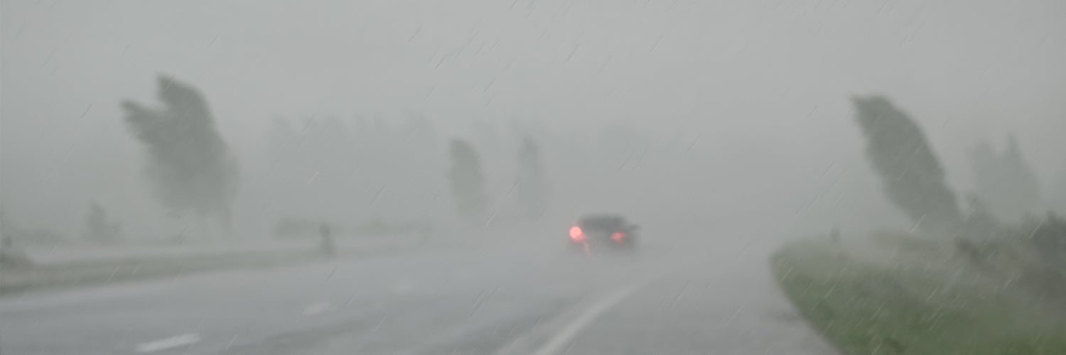
Dangerous Wind Patterns
On top of cloud formations, wind patterns also give us key insights into weather events that are about to occur. Let’s take a look at a few key wind patterns that can alert you to dangerous weather…
High Winds
High winds are classified as any winds that blow faster than 23 knots/26 mph. Though this type of wind isn’t usually life-threatening, it can cause…
- Tree uprooting.
- Damage to power lines.
- Structural damage to poorly built bridges and buildings.
If you notice that wind speeds are higher than normal, consider your safety and stay inside, if necessary.
Downbursts
Downbursts are gusts that are created within thunderstorms due to significantly rain-cooled air that spreads out in all directions and produces strong winds. Downburst winds are not rotational--like tornado winds--but instead move outwards from the point where they strike land or water. These winds are usually short-lived, lasting 5 to 10 minutes, but can reach speeds of up to 100 mph.
If you experience a severe thunderstorm and then suddenly notice heavy winds, it’s possible that you’re about to experience a downburst. Be sure to move inside, preferably into an interior room without windows.
Recognizing Disaster Warning Patterns in the Tides
If you live on the coast, observing tide patterns is a great way to monitor, track, and predict bad weather. Here are a few things to keep in mind regarding tides and devastating storm systems…
Tides and Hurricanes

When a large storm such as a hurricane is building, pressure and water levels rise. This is called a storm surge. This surge leads to high tides that drift further into shore than normal and/or high tides that are present during unusual times of the day.
How do you know if a high tide is unusual? As the National Hurricane Center explains,
“In general, areas along the Gulf of Mexico, except Florida, experience one high and one low tide per day (diurnal tide). Elsewhere the U.S. East Coast experiences two high and two low tides per day (semi-diurnal tide).
When the tide is combined with the storm surge, it is called the storm tide.”
If you notice high tides outside of the normal once or twice a day tide pattern, it’s likely an indication that a hurricane is making its way to land.
Tides and Tsunamis

Tsunami tides work the opposite of hurricane tides. As a tsunami approaches, you will see a sudden and dramatic shift as the tide switches to a low tide. According to the National Oceanography Centre, here’s why this happens...
“As a wave hits the shoreline it rapidly slows to about 50 km an hour (30 mph) but the back of the wave is still travelling faster in deeper water and so is catching up with the front--a water traffic jam is taking place. The water has to go somewhere, so it goes up, building a wave of 10, 20, even 30 metres in height (some 30 to 100 feet). This wall of water finally arrives at the coast travelling at 30 to 50 km/hr (30 mph) causing massive destruction.
Why does the water level drop before the tsunami hits? Because it is like a tide, the tide goes out before it comes in. Traditionally we used to call these features ‘tide waves’ because they behave like a tide.”
If you ever notice a sudden shift in tides in which the tide line rapidly pulls back, vacate the area immediately and head for higher ground.
The Importance of Staying Up to Date on Fault Line Activity

Finally, if you live near any major fault lines, it’s important to regularly monitor fault line activity that might signify an impending earthquake.
There are 5 major fault lines in the US that you should be aware of.
The Cascadia Subduction Zone: This fault line is 680 miles long and resides on the Pacific Northwest coastline. It’s located near 3 major metropolitan areas--Portland, Seattle, and Vancouver.
The New Madrid Seismic Zone: The New Madrid Seismic Zone is 150 miles long and stretches across southeastern Missouri, northeastern Arkansas, western Tennessee, western Kentucky, and southern Illinois.
The Ramapo Seismic Zone: The Ramapo Fault line is 185 miles long and runs through Pennsylvania, New Jersey, and New York.
The Hayward Fault: The Hayward Fault is approximately 74 miles long and runs along the western base of the hills on the east side of San Francisco Bay.
The Denali Fault System: The Denali Fault is located in Denali National Park (Alaska). This National Park houses part of a massive mountain range more than 600 miles long.
Those are the majors. There are dozens of other fault lines that can be dangerous as well, like the San Andreas Fault in southern California.
Scientists and geologists who are stationed around fault lines often monitor seismic activity via seismographs that record ground motion. To find updated information on fault line activity near you, conduct an online search. You will find that many organizations and universities post updated seismic activity information for your area.
Keep in mind that earthquakes are pretty hard to predict. That being said, even the smallest amount of activity can alert you to a dangerous impending earthquake in your area. We live in a wild world where unexpected natural disasters occur more often than we’d like them to.
It’s reassuring to know that, while we can’t always prevent a disaster from happening, we can pay attention to our surroundings and prepare ourselves in the event that a massive storm system, tsunami, or earthquake should occur.
And it’s always important to double-check your preps and ensure you’re not missing something important should a disaster strike without warning. The last thing you want to find out is that you’re not as well equipped as you thought you were heading into an emergency--at the same time that everyone else does. Dealing with the resulting chaos at the grocery, hardware, and other specialty stores will be just another obstacle during a time of crisis when time is all too short. Review our list of 15 of the top preparedness items that disappear quickly off of store shelves when a crisis occurs. It’s an easy way to quickly see where you stand in terms of emergency preparedness.
I truly hope you’ll take the information we covered today and apply it to keep track of the weather patterns and natural disaster indicators. Doing so will prepare you to keep your family out of harm's way.
Please stay safe, alert, and prepared.
In liberty,
Grant Miller
Preparedness Advisor, My Patriot Supply
